Olli Erkkila presents the forkless cruiser, enjoy!
Friday, December 31, 2010
Walkability - The Hot Topic

For those following urban design literature or nonmotorized transportation research, these results may not be shocking. However, new research by Shannon Rogers entitled Examining Walkability and Social Capital as Indicators of Quality of Life at the Municipal and Neighborhood Scales, shines light on the correlation. Rogers, a Ph.D. Candidate at University of New Hampshire, summarizes her findings by stating “that neighborhoods that are more walkable had higher levels of social capital such as trust among neighbors and participation in community events.” Rogers does admit the study does not “prove” a correlation and may be biased – acknowledging that "people who enjoy walking may choose to live in more walkable neighborhoods."
Walkability has become one of the prominent issues in planning, design and transportation. A popular metric used to measure walkability is Walkscore.com which also examines transportation access and provides neighborhood amenities. Walkscore.com recently published their Top 10 Most Walkable Cities list including: San Francisco, New York, Boston, Chicago, Philadelphia, Seattle, Washington D.C., Long Beach California, Los Angles and Portland Oregon.
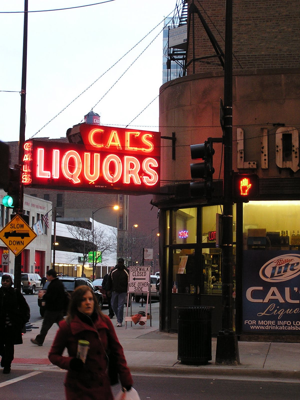
However, do not be fooled by the metrics. The street network, clustering of amenities and access to transit are great but not safe. A recent San Francisco Chronicle piece titled S.F. streets particularly mean for pedestrians states “more than 800 people are hit by cars in San Francisco each year, making it one of the most dangerous cities in the state - and possibly the country - for pedestrians.” If that number appears high to you, consider San Francisco’s small population and relatively high percentage of pedestrians. The Financial District and Tenderloin neighborhood fair the worst. The city is attempting a pilot project to lower speed limits to 15 miles per hour in targeted areas.
Thursday, December 30, 2010
Visions for 2011 – Hello Village, and Bye Bye Vibrant
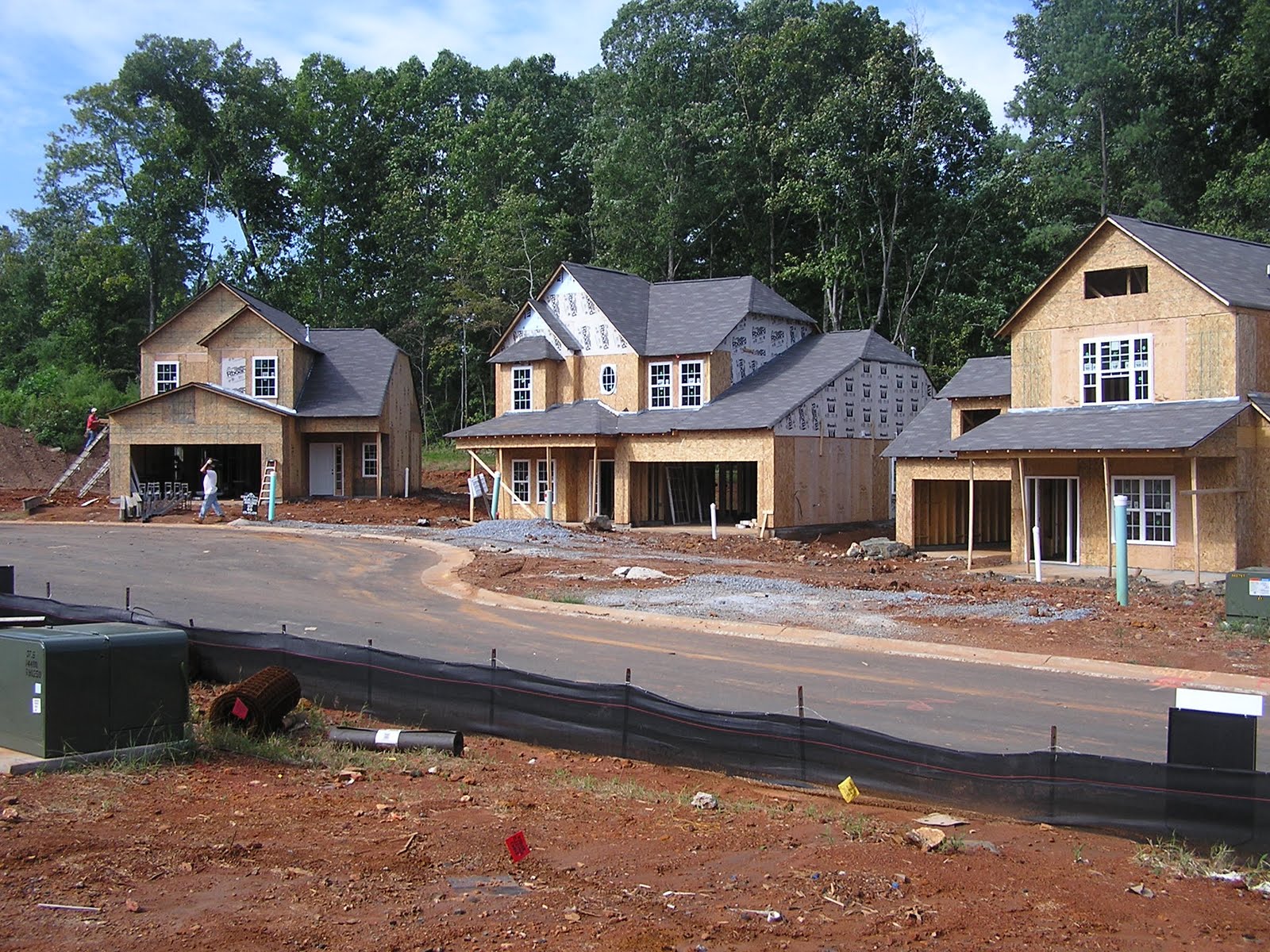
How will 2011 differ from years past? Jenny Sullivan at Builderonline.com predicts a village revival with small eco-green cottages. Surprisingly, homes are still being built, more modest in number and size. Sullivan claims that trends are changing as “America continues its search for a new normal.” Sensibility is a new theme along with natural interior finishes. Walking is “in” and AIA chief economist Kermit Baker reports that smaller scale infill will help create “light urbanism.” Multigenerational housing is also being incorporated into the mix as families are blending to economize. An increase in accessory units is also slated for 2011.
Aside from design, what else will 2011 have in store for us? Kaid Benfield at NRDC contemplates the outcome of transportation reform – “the collapse of the Democratic Congress, along with public backlash against federal spending, have dealt a serious blow to the once-promising prospects for reform.” He wonders if highspeed rail proceed and asks, “Are outer ‘burbs really done?” Will the ‘burbs rebound? And lastly, Benfield vows to never use the word “vibrant” in a post again. We’ll be watching, stay tuned, and Happy New year.
"The Best Day of My Life"
A neighborhood in Bristol closes streets for after school play, according to one youngster "(this was) the best day of my life!"
Playing Out from Paul Gilbert on Vimeo.
Monday, December 20, 2010
The Vision for SAFETEA TWO

Earlier this month, the house passed another extension to SAFETEA-LU, the transportation reauthorization act. Many have supported the extension including the experts at Brookings and Transportation for America. However, many are yearning for more long-term reliability. Reauthorizing every few years does not grant the financial clout necessary to take on long-term projects; many stagnate or are never started.
Robert Puentes, Director of the Metropolitan Policy Program at the Brookings Institute, proposes a new Transportation Law entitled SAFETEA TWO. D.C.Streetsblog summarizes his proposal as:
Model a new evaluation system for project proposals on TIGER, basing awards on merit and performance metrics. Add more transparency and specificity to the process. Make TIGER and the High Speed Rail program permanent.
Start transitioning from the gas tax to a more direct user fee system, like a Vehicle Miles Traveled (VMT) fee. Support “aggressive research” and development, especially to address concerns about privacy and administering a mileage fee. These issues will take time to iron out, and the next two years are a perfect time to do that work.
Invest in a strategic framework for multimodal freight movement.
Establish a national policy for road pricing, including “standard tolling, variable pricing, high occupancy toll lanes, cordon and area-wide schemes.” Remove “archaic” restrictions on interstate tolling and utilitze state-of-the-art toll collection technologies.
“Help those that help themselves.” Offer federal incentives to encourage local self-financing, as when voters approve tax increases to pay for transit improvements.
Strengthen coordination among financing tools like TIFIA and private activity bonds to ease the process for applicants and embrace more complex and ambitious projects. A unified infrastructure financing system could also set the stage for the transition to a National Infrastructure Bank.
Expand the use of Public-Private Partnerships with a governmental office designed, not to make decisions about PPP projects, but to provide quality control and technical advice.
Work on reducing construction delays by instituting rewards for on-time project delivery and forgoing unnecessary environmental reviews (but keeping the necessary ones).
Allow greater use of federal funds for rail maintenance to address concerns like those expressed by anti-rail politicians in Ohio and Wisconsin about state financial burdens.
Cut some “legacy” programs, like the half-billion-dollar Appalachian Development Highway System Program, that are redundant with other federal agencies.
These steps are geared towards the current economic times. After the launch of SAFETEA TWO, Puentes suggests a six year reauthorization when the dust settles. Even without a long term reauthorization now, realignment must occur for projects to move forward with more fluidity and confidence.
Sunday, December 19, 2010
LEED ND - Great System, Room for Improvement
Many have waited years for the release of the USGBC’s LEED ND rating system. The LEED ND system “was designed as a market transformation tool” and is the most holistic LEED system released to date by requiring “the neighborhood… to be situated in a place that makes sense from a transportation standpoint.” Some have even claimed that this is the USGBC’s attempt to “set (the) first national standard for neighborhood design.”
There are many positives for the rating system and building sustainable neighborhoods. Village Homes in Davis, California is often used as a case study for “bottom line savings associated with green communities” (Baker 2007). The community was built in the 1970s and homes now “command $10 to $25 more per square foot than those of surrounding subdivisions.”
However, there is room for improvement. USGBC fees impact certain projects, potentially causing some projects to forgo results for documentation. Another criticisms stems from how credits are weighted in the system. Looking specifically at the LEED ND system, few technical issues arise. Lastly, long-term metrics should be incorporated into the system also focusing on the issues of causation and mode choice.
First, let’s examine the USGBC fee structure. For instance, if the goal is to provide sustainable low-income housing, how do the USGBC fees play into the financing? Are projects paying for documentation and not results? Do the fees stifle smaller projects with more restrictive budgets? And, if the goal were to produce the most sustainable projects, would it not seem more critical to invest the money to further the project than to receive a credential?
Another large criticism against the LEED rating systems is how credits are weighted. For example, the LEED ND environmental categories are approximately evenly weighted. But the Smart Location and Linkages category is by far the most important in shaping change from a land use perspective. Even factoring in the few points available for Regional Priority does not weigh heavily enough on overall environmental priority. The Bicycle Network credit and the Minimize Site Disturbance During Construction credit both receive one point, even though the network might be easier to implement, it may be far more important than other credits with higher ratings.
The rating system has been through many revision processes and vetted through USGBC, CNU, and NRDC. During the revision process many changes were made to the SLLc3 for locations with reduced automobile dependence by increasing levels of transit service. Overall, the threshold was raised and the credit requires that the transit must be in place, not planned for the future. Other revisions updated the Walkable Streets Prerequisite to limit garages in the front of homes, “only 20% of street frontages may be occupied by garages.”
Additionally, the SLL prerequisite for location is “the most important single standard.” Under option 3, the prerequisite requires development to locate “on a site with existing and/or planned transit service such that at least 50% of (the) dwelling units and nonresidential building entrances are within a ¼ mile walk distance of bus and/or streetcar stops, or within ½ mile walk distance of bus rapid transit stops, light or heavy rail stations, and/or ferry terminals.” With the latest revisions, development may achieve this prerequisite by locating near “planned transit as if they have actual, existing transit service” even for bus routes which are less certain. The prerequisite should be stronger, requiring development around existing transportation nodes. There is similar criticism for the NPDC3 Mixed Use credit allowing planned land uses to count towards compliance, where uses should already exist.
The recent revisions also weakened other credits such as the Wetlands and Water Body prerequisite. The required buffer dropped from 100 feet to only 50 feet. There are many credits aiming to protect or restore wetlands. Understandably, their aim is to protect these fragile areas, what happens if a project does not even have areas defined as wetlands? There are four credits with four points that are not applicable for these projects. Is LEED ND encouraging development near wetlands, in order for developers to avoid disturbance and obtain a credit? Would it not be best to just develop on lands not containing wetlands?
The potency of other credits was also diminished. The Agricultural Land prerequisite was minimized with the new standard requiring “mitigation, but only for the lowest-density projects" and exempting projects served by transit or planned transit. In NPDC9 Civic and Open Spaces, parks do not receive any specific credit. Certain credits should be required, like historic preservation and rightfully so, it is often argued that older buildings are more energy efficient and their character adds to the charm of the neighborhood.
Overall, credit achievement should be based on existing conditions to strengthen infill development and accurately reflect the sustainable design goals inherent in LEED ND rating system. The rating system has many achievements, but the credits are “disproportionate to their effect on environmental performance” where location should outweigh design. Lastly, allowing projects to achieve an extra point for having a LEED Accredited professional seems like an act of self-promotion. Smaller projects may not be able to afford such expertise and should not be disadvantaged for such reasons.
The LEED ND rating system is also lacking long-term metrics to measure future usage. Will projects maintain their low income housing balance? Will transit infrastructure and bicycle lanes be maintained? The LEED ND credential should not be a box that is simply checked at the end of the project, when the project’s life begins at occupancy. Follow up measurements should be developed to ensure that projects continue to operate with LEED ND’s design intent.
Lastly, the rating system provides many opportunities to create vibrant spaces to entice pedestrians and use of alternative transportation. However, the system does not factor in the element of choice. If LEED ND projects are encouraged to infill or located near existing neighborhoods, what is the existing mode share for that area? Do people that enjoy walking, choose to live in certain neighborhoods? How does this effect the design considerations set by LEED ND? Would these projects attract people that already have a predisposition to alternative transportation?
Similarly, are people moving to LEED ND communities that already use alternative transportation? Are we simply moving people to newer walkable communities, or are LEED ND projects helping reduce vehicle miles traveled? How do the vehicle miles traveled in a LEED ND community compare to the neighboring communities?
Implementing a LEED ND project helps continue the walkable street pattern. People “walk more if they move to a neighborhood with a more attractive appearance;” however, “changes in the built environment are important, but apparently no more so than other variables, including attitudes and preferences.” LEED ND should attempt to measure attitudinal elements as factors of project success.
Friday, December 17, 2010
Fair Weather Cyclist? No More!
The temperatures have dropped here on the East Coast and so have the cyclists, or not? A collection of articles were published recently, providing tips and some cleaver ways to ride through winter. Cover the essentials, ears, face, fingers and toes. In this article, they recommend a balaclava for the face or facemask. Buy a good pair of water and wind resistant gloves, if it is terribly cold where you live – you may want a pair of lobster gloves to keep the fingers together for warmth. Wool socks are fantastic and booties work wonderfully if you ride clipless. Check out this “how to” article showing a quick way to make snow tires with zip ties. Enjoy, ride safe, stay warm!
Monday, December 13, 2010
Simply Refined – New Goals for Smart Growth by Kaid Benfield

Taken from Smart Growth Principles for the 21st Century by Kaid Benfield with the NRDC.
1.Foster neighborhoods hospitable to residents with a range of incomes, ages and abilities.
2.Enhance, create and maintain communities that encourage healthy living.
3.Provide walkable access to shops, amenities, and services, including good schools, healthy food, and parks.
4.Accommodate and provide a variety of convenient, safe, affordable and efficient transportation choices.
5.Respect nature, integrating natural areas and systems into regional planning and neighborhood design.
6.Identify, respect and enhance the strengths and character of existing communities.
7.Keep regional footprints small and discernible, limiting the encroachment of new development onto natural and rural land.
8.When constructing new development, use land efficiently, with design appropriate to the context.
9.Encourage collaboration in planning and development that leads to predictable, fair decisions that benefit all stakeholders.
10.Take advantage of resource-efficient design, development and management practices.
BWM Releases 97.5% Recyclable Train Car
The Siemens Inspiro system uses light-weight aluminum cars to increase recyclability and efficiency. The new train cars were designed for Poland’s new light rail system and aims for a 2012 installation. Siemens, BWM and Poland collaborated on the design. The design is cutting edge and will help divert wastes from a landfill. However, recycled materials were not used in making the cars. The next logical step would use recycled materials to build the trains, and really close the loop. Enjoy the video,
Friday, December 10, 2010
Tuesday, December 7, 2010
Tuesday, November 30, 2010
Urban Design Literature Review
So, for my current research, I am reviewing the urban design classics. Have any suggestions? Here is the short list for now:
Alexander, Christopher. The timeless way of building . New York: Oxford University Press, 1979.
Appleyard, Donald, M. Sue Gerson, and Mark Lintell. Livable streets . Berkeley: University of California Press, 1981.
Ben-Joseph, Eran, and Michael Southworth. Streets and the Shaping of Towns and Cities. New York: McGraw-Hill, 1996.
Gehl, Jan. Life between buildings: using public space. New York: Van Nostrand Reinhold, 1987.
Lynch, Kevin. Good city form. Cambridge, Mass. [u.a.: MIT Press, 2001.
Marshall, Stephen. Streets and patterns. New York: Spoon Press, 2005.
Moudon, Anne Vernez. Public streets for public use. New York: Van Nostrand Reinhold, 1987.
Soderstrom, Mary. The walkable city: from Haussmann's boulevards to Jane Jacobs' streets and beyond. Montreal: Véhicule Press, 2008.
Whyte, William Hollingsworth. The social life of small urban spaces. Washington, D.C.: Conservation Foundation, 1980.
Wednesday, November 24, 2010
Giving Thanks – Nine Books that Shaped My Career

Many of us will celebrate Thanksgiving tomorrow, a joyous time to be grateful and spend with our loved ones. Aside from a supportive family, best friends, great health and so on – I wanted to take time to thank those who have written books that have changed my career. I wrote part of this post over the summer just before moving to California for graduate school.
The process of moving to California has forced me to confront my belongings over a long period of time. First I had to determine what I needed over the summer and then prioritize what was going to California, reorganize and pack. I had budget and a finite amount of things that the movers could take. The heaviest and bulky items were sent, some of the valuable things were shipped as well. Then I had to sort through what was left, I would ask myself ‘is the item worth keeping in storage until it too can make the long journey to California?’ Many things were donated and the final twelve small boxes remained.
You might ask, “What were these boxes filled with?” I had a few boxes of clothes, but the majority of the boxes were filled with papers from graduate school and books. Books have been my biggest weakness during the entire move. What to do with the books? I already left boxes of books in the trunk of my car, desensitizing myself to their charm in preparation to donate them to Bookthing. I face down another 9 of my favorites right now and think about their influence on me personally, academically and career wise. Behind each cover, an anthology of knowledge and inspiration. The 9 books that notably shaped my career as an environmentalist and I could go on.
So in an effort to part with these popular titles, I will write briefly about each one in hopes to simplify the separation process. In no particular order…
Cradle to Cradle
William McDonough & Michael Braungart
Recommended by my friend Christopher Rampton during my internship at Skanska USA Building Inc. My copy still contains six large green post-it notes and countless dog-eared pages. An amazing read, the concepts within and the durabook idea really lit the CFL above my head and caused me to read numerous other books on this list. I also referenced this title in my undergraduate thesis, the main catalyst for my entire career post construction.
The Ecology of Commerce, A Declaration of Sustainability
Paul Hawken
I am not sure if this title came next on the sustainability book reading binge or the next title by Ray Anderson. Written in 1993, do I NEED to say more?! Hawken continued to strike the fires within confirming that sustainability is not a new concept. Flipping through its pages, I long to revisit the wisdom contained inside and I realize, again, how difficult it will be to part with such treasures.
Mid-Course Correction, Toward a Sustainable Enterprise: The Interface Model
Ray Anderson
A fellow graduate from the Georgia Institute of Technology, my hero and role model, Ray Anderson and he initially inspired me with this title. So thrilled, I remember reading this book in one weekend in 2005. As an introduction to my undergraduate thesis, I included the poem on page 174 entitled Tomorrow’s Child, still marked, dutifully, with a post-it strip. I fumble through the heavy recycled pages and find a quote from Thoreau, “What use is a house if you haven’t got a tolerable planet to put it on?” Sigh, these were the Pre-Gore days.
The Consumer’s Guide to Effective Environmental Choices, Practical Advice from The Union of Concerned Scientists
Michael Brower, Ph.D. & Warren Leon, Ph.D.
Contained within, four post-it notes and a receipt from Starbucks dating February 5th, 2006 during my grande iced mocha phase! Memories! This title really spoke to me, being the first to really spell out that people as consumers vote everyday with their dollar. We have the ability to change our habits and inspire others to become more environmentally conscious. The book is hard to put down, even to write this response. There are so many amazing tidbits of knowledge, although, compiled in 1999, I am sure it is a tad outdated.
Earth in the Balance, Ecology and the Human Spirit
Al Gore
Environment! Eco-nomics and Externalities! Oh my! I read Gore’s book within a year after viewing An Inconvenient Truth. Written in 1992, yes, nearly 20 years ago, Gore laid out a comprehensive analysis of the immense importance of striking the right balance between economy, government, resources and humanity. As Time Magazine states “His book itself is an act of leadership.” I give many thanks to Gore for putting the environmental crisis at people’s dinner tables.
Silent Spring
Rachel Carson
A classic, as I hold this book, I pause and take a breath. The cover says itself “The classic that launched the environmental movement.” I read the majority of this book on a flight from Atlanta to Toronto, with Paris as the final destination. My boarding pass was still tucked into the pages, flight DL4950 departing August 31st, 2007. My heart winces at chapter 8’s title “And no birds sing” which is related to Keats’ “The sedge is wither’d from the lake, and no birds sign.” I lament from the immense sorrow DDT imposed, with losses innumerable. The book almost looks untouched as I am always careful to never bend the spine.
Frozen Earth, The Once and Future Story of Ice Ages
Doug Macdougall
I read this shortly after moving to Baltimore for my graduate program. I was so intrigued by anthropogenic induced glacial changes; I decided to write a research paper for my Hydrology class examining the topic.
Field Notes from A Catastrophe
Elizabeth Kolbert
In her thrilling title, Kolbert covers various case studies impacted from climate change. On the back cover, Robert F. Kennedy, Jr. reveals “In this riveting view of the apocalypse already upon us, Kolbert mesmerizes with her poetic cadence.” My hardcopy, adorned with pristine dust jacket, prompted me to learn about climate change’s impact on the Comma butterfly, Shishmaref’s erosion, and flooding in the Nile river delta.
Crimes against Nature, How George W. Bush & His Corporate Pals are Plundering the Country & Hijacking our Democracy
Robert F. Kennedy, Jr.
A rather humorous read. I presented a brief paper to my Environmental Real Estate class about the air pollution in Port Arthur, TX due to the refineries. My Professor quickly interrupted me by stating anyone can write a book, I was speechless. I later found that he was a Bush-appointed official for the EPA and not everyone that teaches in an environmental science graduate program is in fact a liberal.
Exploring each book has left me a bit saddened and broken hearted. Writing this commentary has only strengthened my bond with these priceless texts as I remember not only their contents but also what I was doing at that time in my life, where I was going and what I longed for in my academic pursuit. Their writers, their contribution to society has exposed and inspired so many. I am undeniably grateful for their efforts as the road is long, risks are great and persistence, knowing a day’s work is never done.
Needless to say, I never donated the books. I simply shipped them to Davis media mail. Happy Thanksgiving!
Monday, November 22, 2010
Walkability and the Importance of Street Design : A Fifteen Minute Writing Exercise
Sidewalk design plays an important role in increasing walkability in an area. The architectural features adjacent to sidewalks are also important. Certain features entice people to walk. Often people just want to be around other people – to be seen. Designing street fronts with the pedestrian in mind drastically alters the street. While recently walking in San Francisco’s financial district – I noticed I was surrounded by parking garages on both sides of the street. Who would walk down this block and why?
Too often streets are designed for one user in mind – the automobile. Engineers and planners fuss endlessly about parking capacity and traffic volume while our cities’ street life decays. If we are concerned about lowering vehicle miles traveled, then maybe it should be least convenient to drive. Street design is only one component. People may walk for pleasure, but wouldn’t it be best if there was a destination in mind?
Sunday, November 21, 2010
Part II Hydrogen Fuel Cell Vehicles: A Fifteen Minute Writing Exercise
A continuation from the piece “Why Private industry will not save us from peak oil,” specifically analyzing hydrogen fuel cell vehicles. As proposed by Joan Ogden, faculty at U.C. Davis, a rather limited network of stations is needed initially in the Los Angeles area for consumers. If so, why have vehicle manufacturers or energy companies not jumped on the opportunity? Where is the chutzpah of capitalism, why is “being a trendsetter” not an admirable title? And furthermore, why are corporations so afraid? Research has proven peak oil and it is a widely known fact that resources are limited. With current knowledge and technology – I am surprised a revolution has not already occurred.
The popularity of the automobile is only growing. In Dan Sperling’s book Two Billion Cars, he discusses the increased demand and impacts from such growth. Driving has even increased in the United States and, unless the recession continues, vehicle miles traveled will increase. Many places have more vehicles than residents, causing a variety of land use and environmental issues.
The hurdle to alternatives may not be the technology but rather the political and economic infrastructure. Our policies support and subsidize the gas powered automobile. Our economic systems do not truly reflect the cost of gasoline – to secure fuel, wars to support trade and demand, environmental impacts, or even the cost of roads, bridges and tunnels. Until the political and economic systems truly reflect the cost of gasoline and infrastructure – any alternative fuel vehicle will lack support form the industry.
Saturday, November 20, 2010
Meeting Paul Hawken

Paul Hawken brought a chuckle and smile to Greenbuild’s closing plenary yesterday. The USGBC offered attendees a revised version of his book, The Ecology of Commerce. I had the pleasure of meeting Hawken at the book signing after the speech. He penned into one of the front pages, “to Jacquelyn, with my blessings, Paul Hawken.” He has impeccable penmanship and a wonderfully lovable personality. He spoke candidly about his struggle to publish his book – how people often criticized his initial draft as being too dark. He talked about being ostracized after his talks and how he had no idea that the book would ever be this successful. Hawken thanked Ray Anderson for his early support. When Anderson read The Ecology of Commerce in 1994, it was a “spear in his chest,” in 2005, the book was a spear in mine along with Anderson’s Mid Course Correction.
When meeting Hawken, all I could do was shake his hand and thank him profusely for his impact by persevering and publishing The Ecology of Commerce. I wished him well, a picture was taken and off I went. I feel grateful to have had the opportunity to thank such a prominent figure in the field – the speech, exchange and his legacy has been and will continue to be nothing short of inspirational.
Monday, November 15, 2010
Why private industry will not save us from peak oil: A Fifteen Minute Writing Exercise

It is a common belief that technology and private industry will save us from dwindling resources and peak oil by developing flex fuel or battery power vehicles. However, when analyzing other industries, the private sector has made certain technological advances, but not necessarily for the public benefit. Private sector businesses are often solely focused on profit, and other endeavors, to benefit the public, fall by the wayside.
For example, how the pharmaceutical industry seeks likely illnesses and diseases to develop curative medicines. There are countless blood pressure medicines on the market, or drugs to treat depression. But what about rare cancers that people still suffer from, what are industries doing for those individuals? Research and development is often spent in areas likely to reap a reward.
Similarly, our food industry has fallen victim to private sector profit mongering. Highly processed foods are more profitable and food makers are pulling all the stops to increase profit and drive down quality. Hormones, pesticides, and antibiotics are all used to keep our food systems “productive,” but what is the value in producing food that makes people ill? All the side effects from this system are placed outside of the economic model. The fact that highly processed foods are likely to cause diabetes is never a line item on the balance sheet.
Likewise, why would private industry automobile and energy companies go out of their way to produce alternative fuel vehicles for the common good? They would be taking a risk, even though peak oil is upon us, they have a profit margin to worry about. In this instance, capitalism is not pushing competitiveness, it is a lame duck with each company daring the other to take the leap and “pave the way.” In these economic times, who is going to reach out and be the Ford of the new century?
Sunday, November 14, 2010


Friday, November 12, 2010
A Summary - Landscape Preservation and the Containment of Urban Growth
Land use and transportation policy co-determine the development of the urban fabric. Sprawling development changes the land use function by developing unaltered contiguous land into fragmented parcels. If uncontrolled and uninterrupted by geographic features, urban growth will continue along transportation arteries and expand outward, creating exurban development to the detriment of surrounding landscapes. The ability to measure sprawl provides an excellent management tool for planners and municipalities to monitor land use development. Municipalities can use this data to strategically implement alternative land use development policies and make projections for future development. Ewing et al. developed the most comprehensive method for assessing sprawl measuring twenty-two factors of development focusing on four major dimensions: density, mix, centers, and streets. Scores are pooled within these dimensions and averaged to create an overall index. The components of the index can be used as a scorecard assessing development trends. Municipalities can monitor development and implement urban containment policies to effectively preserve landscapes. Through continued monitoring, municipalities can later reassess development and critique tactics for harnessing sprawl. The ability to measure sprawl is necessary to implement policy driven strategies for harnessing unsustainable development.
Thursday, November 11, 2010
LaHood puts Foot Down
Secretary of Transportation, Ray LaHood, stood his ground this week by notifying newly elected Republican officials to either spend the dedicated federal funds on high speed rail or return the money.
The Ballet of the City Sidewalk
Excerpt from The Death and Life of Great American Cities – Jane Jacobs
Under the seeming disorder of the old city, wherever the old city is working successfully, is a marvelous order for maintaining the safety of the streets and the freedom of the city. It is a complex order. Its essence is intricacy of sidewalk use, bringing with it a constant succession of eyes. This order is all composed of movement and change, and although it is life, not art, we may fancifully call it the art form of the city and liken it to the dance – not to a simple-minded precision dance with everyone kicking up at the same time, twirling in unison and bowing off en masse, but to an intricate ballet in which the individual dances and ensembles all have distinctive parts which miraculously reinforce each other and compose an orderly whole. The ballet of the good city sidewalk never repeats itself from place to place, and it any one place is always replete with new improvisations.
Monday, November 8, 2010
What is Suburban Sprawl? Ideas to Manage

Suburban sprawl is defined as non-contiguous development occurring on or beyond the urban fridge on land typically classified as Greenfield space. This type of development is characteristically automobile dependent and low density with single use spaces segregated by zoning. Sprawl tends to lack identity, exhibiting the “geography of nowhere” in James Kunstler’s terms.
Communities want to manage growth and minimize sprawl because it is more cost effective to cluster development as there is less infrastructure to manage. By implementing mixed use infill development, communities run less power, water and sewer lines. Also, there are fewer roadways, which are considerably expensive to install and maintain. Emergency services travel shorter distances. In some instances, children may be able to walk to school thus eliminating school busses. There are also many social benefits including increased community interaction and in some cases, lower crime.
There are a variety of ways to limit growth. One of the most stringent, and controversial, ways to limit growth is by implementing the urban growth boundary (UGB) around a community with policies limiting the subdivision of land beyond the boundary. In twenty years, the community may wish to redefine the UGB but until that time, growth occurs only within the boundary. Another way to limit growth is to provide incentives for infill development. Incentives may waive taxes or fees, and could include faster planning approval time lines. Incentives are a more likely measure to limit growth and less politically contentious to implement.
Moving forward, certain policies are necessary to curb automobile use and increase alternative transportation modes. Policies need to encourage mixed-use infill development that bolsters alternative transportation. Zoning may need to be altered to allow higher densities.
Smart growth aims to implement infill development that mixes use that creates vibrant areas for alternative transportation. Smart growth examines development at a larger scale than the New Urbanist movement, which is more concerned with fine-scale design issues along with community function. Both are effective strategies for managing growth when implemented properly. The New Urbanist communities implemented like Seaside, Florida or Kentlands, Maryland have received major criticism for not having adequate job-housing balance, high automobile dependence, and Greenfield development.
Saturday, November 6, 2010


Monday, November 1, 2010
Clip from The Social Life of Small Urban Spaces
William H. Whyte: The Social Life of Small Urban Spaces - The Street Corner from MAS on Vimeo.
Watching Whyte's film in tomorrow's class.Introduction to Road Design – A Response to Current Times: A Fifteen Minute Writing Exercise

Transportation planning in the United States is a complex endeavor involving federal, state and local governments. Transportation planning and road design have two main purposes, to create mobility and accessibility. Different designs are used for different functions. For instance an interstate a few access points but high speeds for mobility. Conversely, cul-de-sacs have high accessibility with limited mobility.
The urban fabric comprises of a complex network of phenomena. Spanning time and consisting of many layers; community design, the marrying of architecture, planning and socioeconomics - planning is a response to current phenomena. Thought of as a positive response to the ills of that era.
For example, the Garden City inspired Radburn plan in Fairlawn, New Jersey, some 16 miles from New York City, and designed by Clarence Stein and Henry Wright. The Radburn plan was a direct response to increased automobile usage, congestion, squalor, and gridiron of New York City at that time in the mid 1920s. The Garden City concept implemented curvilinear streets, used a hierarchy of streets, and conserved land for public green space.
Thursday, October 21, 2010
A Brief Introduction to Pavement Design: A Fifteen Minute Writing Exercise
According to Southworth and Ben-Jospeh in Streets and the Shaping of Towns and Cities, roads, parking lots and other automobile related infrastructure count for 50% of land use in most U.S. cities. Roads date back to Roman times. Whereas the idea of engineered roads was introduced approximately 200 years ago. In the U.S., the majority of the roads have been built. Engineers are now focused on the management and maintenance of our already existing infrastructure.
Pavement is an engineered structure on the ground that facilitates the movement of goods and people. Pavement is implemented for all weather mobility for higher safety, efficiency and fuel economy. Pavement design can have a huge impact on the environment, energy consumption, connectivity, labor, maintenance, etc. There are many different types of pavement, some dirt roads are coated with one thin layer of pavement to increase fuel economy by reducing rolling resistance. Coating dirt also helps decrease dust and noise. Other pavements are very thick, like the deep pads used for rail road subsurface.
The pavement subsurface helps displace the load from vehicles or trains. The majority of the damage to roads comes from trucks. A truck traveling down the interstate is similar to the damage inflicted by 5,000-10,000 sport utility vehicles. Trucks are limited to 40,000 ton carrying capacity due to safety and stopping distance. More damage is done to the roads when trucks implement high tire pressure or have less tires to displace the load. However, there are trade offs. If trucks were able to carry 10% more weight, green house gas emissions would decrease due to efficiency.
Wednesday, October 20, 2010
I Choose, Therefore I Walk (Bike, Bus, Drive...)
Do people walk down unpleasant streets, bike on roads without a bike path and drive when they do not have to? Sure, this occurs everyday. The notion that people drive more in the suburbs and walk more in the city is now complicated by the idea of choice. Granted accessibility and income largely dictate transportation mode choice, new studies by Handy and Mokhtarian, "Which comes First: The Neighborhood or the Walking?" question the causes for such outcomes. Do people that like to walk more simply move to walkable neighborhoods? If so, this challenges the built environments' role in creating walkable neighborhoods. Conversely, if driving is ingrained behavior or people's preference, would it really matter if goods were accessible? Would people still drive? What is your attitude about travel and what would it take to change your behavior?
Thursday, October 14, 2010
When Bicycling Dreams turn into Doubt

The last thirty-six hours have presented a watershed of events, exposing raw bicycling karma. Tuesday I was left by the cycling team on a no drop ride miles from town. Last night, I was nearly hit by a Mustang rolling through a stop sign downtown and this morning, honked at for merging to make a left turn.
If, in a place like Davis, a platinum rated bicycle city, cannot escape angry drivers rolling through stop signs and motorists honking horns, in the belief of a slightest cycling error – what place is actually safe for cyclists? Motorists are not the only culprit, cyclists ride erratically in bicycle lanes, fail to signal or stop at stop signs and oppress the pedestrians to a level of absurdity on campus. I moved 2,700 miles to be mowed down by a barrage of cyclists entering a roundabout on the UC Davis Campus. . .
Is safe cycling an oxymoron? Are we asking for too much, to share a sliver of the road and have the ability to make left turns, safely reaching our destination and becoming an integral part of the urban fabric? Is safe cycling synonymous with Moore’s Utopia, brilliant on paper and yet a fallacy? If Davis is the best for cycling, then why do so many people still drive, and further more – why is it still unsafe to ride a bicycle?
Wednesday, October 13, 2010
Introduction to Traffic Flow, Control, and Capacity: A Fifteen Minute Writing Exercise
Vehicle infrastructure encompasses a variety of road types including: interstate, arterials and neighborhood streets. Each has different characteristics with varying capacities for congestion. The design of each type is different for the variety of uses.
Congestion is a major challenge in transportation planning. The problem is peaking, where massive amounts of vehicles travel at the same time of day, during morning and evening rush hour. There may not be enough capacity at that time of day, however, the infrastructure cannot be built to provide just for the highest peaks. Infrastructure is already overbuilt in most parts of the country. And, congestion can be a good measure for economic productivity and population growth. Although, congestion should be avoided when excessive.
A road’s capacity is based on the maximum flow, or people passing in a unit of time. Weather impacts speeds as well as drivers and vehicle type. A road’s design largely impacts the flow of traffic. Wider lanes lend faster traveling speeds. Topography also plays a role, in flat broad areas, speeds tend to be higher. On the interstate, 2,200 to 2,400 vehicles are able to pass per lane per hour.
On local arterial roads, streets intersect at grade. Some arterials meet at lights or stop signs whereas others may join in a roundabout. Roundabouts may not necessarily be safer for pedestrians or cyclists, because they keep traffic moving. When there is not enough demand at street junctures, a stop sign is placed. When traffic warrants a signal, signals are installed using a variety of techniques to determine signal length and configuration. Some signals are fixed, meaning the timing does not change. Whereas others are semi-activated, where major and minor streets join. Fully activated signals have sensors on each major intersection to direct traffic appropriately. Some signals are coordinated through signal optimization, which considers the speed of the vehicles and block length in order to keep traffic moving.
Sunday, October 10, 2010
The Alphabet of Opposition – NIMBYs, LULUs and NOPEs Oh My!
While reviewing Matthew J. Kiefer’s assessment of NIMBYism, I had to ask myself a David Byrne inspired question, “How did we get here?” With a list of acronyms that carries on to infinity, one may need a lexicon to wade through land use planning decisions. The interesting concept is how people move so often, upgrade and remodel the insides of their homes but then adamantly oppose any change within their community or surroundings. Kiefer mentions that the average America moves twelve times in their lives. Residents fail to accept that change will occur. All the dwelling we reside in were built at some point, changing the initial landscape. So then, when a group opposes change, demanding that it stays the same – define the same. Maintaining the urban fabric of what time period? Are we seeking pre-war era, the City Beautiful Movement, agrarian based villages? Or are we simply chasing our tails in the hopes that we do not have to let go of the things we cherish most about where we live? Is the same, defined as the horizon of the setting sun, an imaginary line continuously moving? Civic engagement has a point, to protect residential areas from imposing industrial degradation, to provide environmental justice and so on. But at some point, a meeting of the minds must occur, and communities must learn that compromise is not a four letter word.
Friday, October 8, 2010
Wednesday, October 6, 2010
Travel Demand and Behavior – Asking “Why People Travel?” : A Fifteen Minute Writing Exercise
Travel demand and behavior examine different phenomena. Both deal with personal choice but differ in many ways. Travel demand is examined at the aggregate or system wide level. Travel demand is used to forecast the future. Travel planners in the Bay Area, for instance, study travel demand to predict the future use and load on the current infrastructure. Where as travel behavior is more local, measured by individual, household or vehicle. Travel behavior studies aim to measure the attitudes and their impact on selection, flexibility and conveniences of a population. A transportation behavioralist may ask “why do people drive versus take the subway?”
So why do people travel? First, people travel because there is a demand to be in different places. People travel to be where they need to be. In this instance, travel is defined as a disutility, something people want to minimize. Second, people travel because they may enjoy traveling, like a road trip versus taking the train. People may enjoy the act of driving. Also, people travel for personal recreation or exercise. Many go on vacation to ski or hike. People inherently like to move and be mobile. Other hobbies include horseback riding, bicycling, running, etc.
Modeling is often used to untangle complex scenarios. Transportation demand forecasting is the workhorse for most metro areas. Modeling can be based on a variety of data, including large-scale travel and activity diary surveys. Diaries entries contain information like whether the participant traveled, where they went, by what means, and which route. Modeling can also factor attitude and opinion of traveling.
Tuesday, October 5, 2010
Critiquing the West Baltimore MARC Transit-Centered Community Development Strategy

The West Baltimore MARC Transit-Centered Community Development Strategy (The Strategy) is a framework document providing guidance for the revitalization of the areas within a half-mile of the current West Baltimore MARC station over the next 35 years. The Strategy proposes the creation of a transportation oriented development centered around the West Baltimore Station, located at Franklin and Pulaski Street, that consists of east and west bound platforms and two parking lots. Designed with heavy public involvement, the Strategy aims to improve the areas by targeting three principals: housing, economic and transportation. The Strategy “is not intended to be the last word on how West Baltimore is redeveloped – rather it is intended to be the first” (City of Baltimore Department of Planning 11).
Typical of most urban areas, West Baltimore’s population declined after World War II due to a variety of reasons: white flight, suburbanization, job loss, etc. Historic race riots occurred throughout Baltimore in1968 stemming from the assassination of Reverend Martin Luther King Jr. Many communities have not rebounded from these events. The Strategy targets communities around the West Baltimore MARC station including: Bridgeview & Greenlawn, Midtown Edmondson, Station West (Penrose), Shipley Hill, Franklin Square, Boyd-Booth, Harlem Park, and Rosemont. Neighboring communities include Union Square and Carrollton Ridge. Based on the 2000 Census, the surrounding communities are roughly 99% African American, largely consist of families and the working class (City of Baltimore).
Local stakeholders include Coppin State University, Baltimore City, Acme Industrial, Bon Secours Hospital, the Maryland Transportation Administration and the residents within the surrounding communities. Public involvement gained momentum throughout the planning process. The first workshop held in 2006 consisted of a week long community planning charrette that led to the creation of the West Baltimore Coalition (WBC), a group of community stakeholders. The WBC recruited neighborhood residents and held monthly meetings to establish direction and specific interest. Also, the WBC distributed flyers to every residence within a half-mile of the MARC station notifying the public about involvement in the upcoming workshop. A second workshop was held in October 2007 and the community developed one goal, “use the MARC station and other transportation improvements to create an affordable neighborhood that is full of residents, shops, restaurants, civic amenities, parks, and other recreational opportunities” (City of Baltimore Department of Planning 18). In November 2007, residents gathered to agree on concepts that are “needed to make West Baltimore a better place to Live, Earn, Play and Learn,” and thus creating the outline for the Strategy (City of Baltimore Department of Planning 18).
The Strategy outlines methods to improve housing, economic development and transportation. Through all principles, each seeks to draw investments to the community. The community also desires greater connectivity to “jobs, schools, medical centers, retailers, and other areas of the city” (City of Baltimore Department of Planning 13). The Strategy plans to achieve all these goals through small-scale infill projects that are sensitive to the already existing community.
The key housing principles include stabilizing current housing stock and avoiding the displacement of current residents by making housing affordable. The Strategy aims to increase housing stock but also preserve the historic character of existing infrastructure. Diversifying the housing stock is also important to create a variety of places to live for different lifestyles. There is a large amount of abandoned housing and the Strategy has identified sensitive infill for these areas.
The community hopes to draw large-scale economic redevelopment into the surrounding area, foster businesses that would serve the local population and provide employment opportunities. Small business development is also encouraged. Redevelopment opportunities include the redesign of the Ice House, a large industrial building adjacent to the MARC station, which could be used as shelter for passengers with restaurants and retail potential. The Warwick industrial triangle, within walking distance to the station, also has similar mixed-use potential.
The transportation principle seeks to use the MARC station more fully and improve alternative transportation modes within the community. “Approximately 60 percent of area residents do not have access to private vehicles,” and rely heavily on the local transit network (City of Baltimore Department of Planning 35). The Strategy makes an emphasis on improving the bicycling and pedestrian environment with new transportation plans that focus on complete streets and traffic calming. Under the transportation principle, the community wishes to dismantle Route 40, known as the “highway to nowhere,” and revitalize the area into a “highway to somewhere,” a tree-lined boulevard with access to the proposed Red Line with high economic potential. The new Red Line, an east to west light rail, proposed a station in West Baltimore. The Red Line would connect West Baltimore to the already existing Baltimore Metro and Light Rail downtown. There is speculation regarding the Red Line, however, its implementation would help create a destination place in West Baltimore.
The Strategy does not explicitly review the financing for the proposed redevelopment, leaving one to ask, “Where will the money come from?” The Strategy may be more convincing if other constituencies were identified that are not currently in West Baltimore. Funding could be generated from paid parking spaces to pay for sidewalk upgrades etc. Identifying the financing options would strengthen the likelihood of implementing such a plan.
Also, the Strategy does not cover the issue of crime. Baltimore City has some of the highest crime rates in the Nation. Within the City, crime is disproportionately located in pockets of East and West Baltimore. Crime is a major impetus to reinvestment in West Baltimore and a difficult hurdle to surmount. The crime stems for deep seated and complex socio-economic problems resulting in high levels of drug and gang related violence. Reinvestment might help quell the violence, but more than likely, the community will have to improve first.
Overall the Strategy is opened minded and flexible to a “range of possible futures” (City of Baltimore Department of Planning 40). In the current economic times, investors may be scarce. However, working with the public and outlining the framework provides a vision for future and marks the starting point. In the meantime, the Strategy could take advantage of existing bus lines and public involvement to clean up the community. The dismantling of Route 40 is currently underway, which will greatly enable development along the corridor. The Strategy is well rounded, not simply improving things for motorists or commuters, but has the potential to make things better in the community and change people’s lives.
City of Baltimore. "City of Baltimore Planning / Research and Data." City of Baltimore, Maryland - Official Website. 2010. Web. 01 Oct. 2010.
City of Baltimore Department of Planning. "West Baltimore MARC Station Master Plan." City of Baltimore, Maryland - Official Website. Nov. 2008. Web. 01 Oct. 2010.
Photo Courtesy of John Perivolaris
Thursday, September 30, 2010
Friday, September 24, 2010
The Central Challenge to Transportation: a 15 Minute Writing Exercise

The central challenge for transportation is a variety of things. A major challenge is coping with sprawling developments in order to take advantage of alternative transportation and density. Land use and transit go hand in hand. To achieve a sustainable infrastructure – developments must cluster to allow a variety of transportation modes. Sprawling development supports automobile dependence and vice versa. People desire high levels of accessibility supported by their complex life styles.
Automobiles do not necessarily equal transportation. Although, automobiles may superficially provide freedom to citizens, in actuality citizens are burdened by their automobile dependence and sprawl induced development. Automobile costs are significantly expensive when factoring in payments, maintenance and insurance. Often, these costs provide a barrier for low income or minorities. Continuing to invest in an automobile dependent society leaves these citizens in exile with few modes and means to find employment.
The issues facing transportation are increasingly complex. A major challenge for transportation are traffic and congestion issues. The frequent saying goes something like, “time is money.” Consider all the money sitting in rush hour on the interstate closest to you. And it is not just the cost of inconvenience, think of all the goods that are also sitting bound up on the interstate to nowhere. The current situation is dominated by the automobile and lacks a sense of balance. The dependence on oil and foreign production is unsustainable and quickly depleting. Our health also dwindles as obesity rates rise along with diabetes, asthma and other illnesses related to automobile pollution, including deaths and injuries from automobile induced accidents. There are social impacts and limitations for those without access to alternative transportation methods. The considerable lack of cooperation and collaboration is “driving” us to few alternatives. Transportation is a right, not a privilege.
Walmart “Neighborhood Market” Simply a Façade
Knowing how Walmart treats its employees, that its business model has wreaked havoc on local small businesses, and that the majority of its products come from over seas with little quality – the “Neighborhood Market” concept is not tempting me. Walmart is still Walmart and at the end of the day, any purchase is contributing to the machine. Walmart is still catering to suburban auto-dependent clientele, which is typical, and painting with a wide brush, then throwing the term “urban” and “marketplace” to lure in customers. There is nothing different here. And, I am not letting the New Urbanist façade and small scale fool me. For more information, see Kaid Benfield's post.
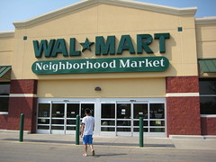
Photo Courtesy of Sixstep's Flickr
Photo Courtesy of Sixstep's Flickr
Wednesday, September 22, 2010
Thursday, September 16, 2010
HOT Lane – Making Interstate 680 Sexy in the Bay Area
The Bay Area’s first express lane will be unveiled next Monday. The 14 miles express lane will start at Highway 84 in Sunol and end at Highway 237 in Milpitas, operating from 5 a.m. to 8 p.m. Monday through Friday. Motorists will have a one mile warning before entering the lane, and tolls are announced prior to entry. The lane allows single occupancy vehicles to travel with those carpooling for a fluctuating toll based on congestion. Tolls will range from “a minimum of 30 cents when traffic in the other lanes is light to a maximum of whatever it takes to keep traffic flowing at 50 mph or faster. Express lane officials estimate that cost will average $4 to $6.”
The HOT Lane is only separated from traffic by two white lines painted on the pavement. There will be a few designated entrance and exit points as well as California Highway Patrol watching for violators. If vehicles are found in the lane without a transmitter, police will pull the vehicle over - “citations start at $381 and vary by city and county.”
The lane provides drivers with an option. Mark Green, Union City mayor and chairman of the Alameda County Transportation Commission adds, "If you're late to a job site, if you're late picking up your kids, if you're late getting to Little League baseball practice. It's a tremendous opportunity for people."
Wednesday, September 15, 2010
How much is a bus line worth?

With MTA’s recent transportation cuts in New York City, property values are taking a hit. In an article by the Wall Street Journal, one real estate agent in Astoria said apartments that “easily sold for $500,000 with the express bus nearby are now languishing on the market at prices about $420,000.” That is an $80,000 decrease, multiply that along the potential length of the route and the result is a huge financial impact – an amount far greater than the cost of maintaining the line.
MTA does not reap any rewards from the surrounding property value, atleast on the balance sheet. Stephen Smith points out in Internalizing Transit Externalities, that at “the turn of the century, when America’s great mass rail-based transit systems were being built, they were often built by developers who had large stakes in land around their stations.” Also, he adds that Japan and Hong Kong are backtracking and investing in land around their transportation hubs to generate high ridership. It is unlikely that the rail in NYC will become privatized. However, private bus services are trying to make a comeback and deemed a “palatable stepping stone.”
Tuesday, September 14, 2010
Exploring the National Infrastructure Bank
C-Span interview with Robert Puentes, Senior Fellow at the Brookings Institute Metropolitan Policy Program. Interview answers tough questions on the newly proposed National Infrastructure Bank and calls for the depoliticizing of the national transportation system.
Unveiling the Ergonomic Crosswalk

A new crosswalk design was proposed at the Seoul International Design Competition based on pedestrian behavior. Pedestrians rarely cross streets in a straight line and to provide for their safety, Jae Min Lim designed the curving ergonomic crosswalk. (Pictured here courtesy of Design Boom.) With the advent of the complete streets movement, it is important to understand how each user interacts with their space. Acknowledging how pedestrians approach and then cross a street could have major impacts on design and safety. In his article, Mathew Roth notes “These new designs begin to reflect a new consideration in street design, where cars are not the primary consideration, but people and public spaces are valued as much as movement of vehicles.”
Friday, September 10, 2010
The Argument for “More Transit = More Jobs”

Transportation Equity Network’s (TEN) latest report “More Transit = More Jobs” created quite a stir this past week with commentary ranging from Transportation for America, two fellows at National Resource Defense Council, Streetsblog and a whole host of others via world wide web. Kaid Benfield with NRDC chimes in “People take for granted that “shovel-ready” highway projects create jobs. But investment in public transportation may be even more effective in generating employment.” Streetsblog even boldly titles their article “Report: Investing in Transit Could Create 180,000 Jobs, for Free.” In an era where nothing is free, how does investing in transportation actually create jobs?
TEN’s report first ranks metro areas by percentage of transit spending then proposes shifting 50% of the current highway spending to fund transit projects. New jobs would be created by bolstering the alternative transportation sector and further supported by a new Transportation Authorization Act. TEN’s report concludes with six case studies analyzing: Honolulu, Detroit, Minneapolis-St. Paul, St. Louis, Denver, and Portland job creation potential.
On John Horner’s NRDC blog, he supports the new usage of funds and provides this example for the Bay Area improvement.
If the San Francisco Bay Area (which, as a percentage of total transportation spending, already spends above the national average on transit) were to shift 50% of its highway dollars to transit, we'd see a net increase of 23,264 jobs over five years. That's more than 20,000 just by shifting around money we're already committed to spending (i.e. No New Money!).
This is not just about transportation spending. A new study from the Michigan Department of Transportation shows “that for every 10 jobs created in the public transit sector, six additional jobs are created in the rest of the economy.” Sounds like a plan, what next?
Deconstructing an Interstate, The Claiborne Expressway
“The timing… should be perfect,” claims Neil Peirce, a member of the Washington Post Writers Group. In his recent article, Time To Accelerate Freeway Teardowns?, Peirce dives into New Orleans’ desire to deconstruct the Claiborne Expressway. Along with the Center for New Urbanism (CNU), citizens alike want to deconstruct the dilapidated 2.2 miles of elevated expressway bifurcating their city.
The portion considered for demolition is a spur highway and nonessential. The elevated Claiborne Expressway was constructed over the once culturally vibrant Old Claiborne Avenue. With its construction, business suffered and communities on either side segregated. Old Claiborne Avenue linked walkable neighborhoods and had a tree shaded median. Businesses flourished from 132 in 1960 and then dwindled alongside the interstate to a mere 35 in 2000. And typical of elevated roadways, “poverty and decay reigned, the stark expressway section creat(ed) a hostile no-man’s land around it.”
The Claiborne Expressway is aging and many are analyzing the costs and benefits to maintain the infrastructure. $50 million are needed just to repair the interchange ramps. The choice to deconstruct elevated interstates may become more prevalent as they approach their 50-year lifespan and financial support dwindles. The co-chair of the Claiborne Corridor Improvement Association, Jack Davis says “elevated roadways… are far more expensive to maintain than surface boulevards.” Not to mention the social costs of a deteriorated community. In research provided by the CNU, “regular urban grids, minus the expressways, raise property values, increase mobility, restrain sprawl, and make for far more successful cities.”
The CNU’s Highways to Boulevards Initiative is also examining the take down of ten interstates including:
1. Alaskan Way Viaduct, Seattle, WA
2. Sheridan Expressway, Bronx, NY
3. The Skyway and Route 5, Buffalo, NY
4. Route 34, New Haven, CT
5. Claiborne Expressway, New Orleans, LA
6. Interstate 81, Syracuse, NY
7. Interstate 64, Louisville, KY
8. Route 29, Trenton, NJ
9. Gardiner Expressway, Toronto, ON
10. 11th Street Bridges and the Southeast Freeway, Washington D.C.
Thursday, September 9, 2010
The Personal Cost of Owning a Vehicle
D.C.StreetsBlog examines the True Cost of Cars. Owning a vehicle is a major financial undertaking with upfront, insurance, maintenance and hidden costs. “By 2009, the average purchase price of a new vehicle was over $27,000.” Not to mention the interest paid by financing or other costs. Maintaining a vehicle is the 2nd highest expense for households and sometimes outweighs the mortgage or rent. Car ownership is often presented as providing an idealized sense of freedom, but in these harsh economic times, individuals are crippled with the outlandish costs.
Dealerships are known to prey on those less educated in the market. For instance, in the example provided by D.C.StreetsBlog, “A used car lot… advertised a 6-year-old Hyundai for $9,000 while the actual Blue Book value, more likely to be paid by middle class car buyers, was $2,880.” And granted, the buyer should scope the competition and do the research, but this is a major price hike, and should be considered gouging.
Likewise, car insurance can create an incredible burden for low income citizens, especially those residing in African American communities. In 2005, a survey of three large insurers “found that drivers with clean driving records in some African American communities paid nearly $1,000 more per year than did drivers with similar records living in predominantly white zip codes.” D.C.StreetsBlog further illustrates the outrageous prices stating “Car owners living in some low income areas of Los Angeles can be charged as much as $3,500 per year for insurance.” Some vehicles are not even worth that much and in order to drive, insurance is required.
Better save your money to maintain your vehicle. According to the Department of Energy, the typical two-car household drove 20,000 miles last year. With the assumption that both vehicles were mid-size sedans, and the cost of driving estimated at 73 cents per mile provided by AAA, their total cost was $14,600 for one year! “In a lifetime of car ownership, an American family will likely “invest” almost $1 million in its vehicles.”
Lastly there are the additional hidden costs to car ownership such as “tax bills for road-building, oil and car company subsidies and bailouts, local police and rescue services… costs of road congestion… or the oil-protection services of the U.S. military in the Middle East and elsewhere.” D.C.StreetsBlog makes a critical argument, one worth standing behind, that as the car companies continue to lay off workers and take bailout money, their CEO’s reap high rewards “GM’s just-resigned Ed Whitacre made $9 million last year while Ford’s Alan Mulally pulled in just under $18 million,” for instance. The disparity between the wealthiest Americans and the bottom half of the economic curve continues to grow leaving many who “can’t live with the car and they can’t live without it.”
Tuesday, September 7, 2010
Dead Man Walking Infograph
Lived in 3, worked in 1, hit by car once and lived to tell. Why does walking and cycling mean "taking your life into your own hands?"
Renewing and Expanding America’s Roads, Railways, and Runways

In President Obama’s Labor Day Speech yesterday, he announced a $50 billion plan for “Renewing and Expanding America’s Roads, Railways, and Runways” to construct and maintain 4,000 miles of rail among other transportation upgrades to aviation, freight and roadways.
Robert Puentes, Senior Fellow at Brookings’ Metropolitan Policy Program, wonders if President Obama’s approach is enough “given the poor state of our transportation network today, our overall investment needs, and the urgency of repairing our broken policy apparatus.” Puentes notes that the transportation discussion this year is different, mainly in terms of the high unemployment rate in the construction sector topping 27% in February and still an outrageous 17% this month. Global competitiveness is also spurring action as the U.S. falls behind other nations modernizing their infrastructure: China, Germany, India and Brazil.
There is not a shortage of great ideas, Puentes continues, the shortcoming stems from long-term reliable investments and sources for funding. Puentes agrees with Transportation for America in the need to establish a long-term transportation bank for the future to jump start new initiatives and repair existing systems. Benefits continue on a temporary basis not suited to maintain our systems. Via the handy counter, located on the Transportation for America website, approximately 342 days, 14 hours and 30 minutes have passed since the last transportation law expired. Transportation for America notes, “The alternative is gridlocked cities, stranded rural residents, hampered freight delivery and continued over-reliance on increasingly hard-to-get oil supplies.” And Puentes calls for a “frank conversation” over funding, bluntly stating “A jump start now is no good if we stall again down the road.”
Subscribe to:
Posts (Atom)